Natural Capital – Drones, Data and Decision Making
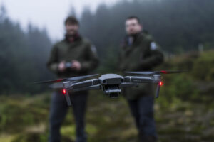
In this episode of Natural Capital we are getting techy, discussing all things drones, data and technology and how this can be used by land managers to assess, monitor and improve their natural capital assets. Understanding the natural capital you have on your land, its condition and scale is essential to effective land management.
To help us understand this better we are joined by Jack Zuill, who is a consultant experienced in using technology to monitor and assess natural capital assets. This includes the use of drones and satellite-derived remote sensing data to optimise environmental monitoring and decision-making. We talk through some of his recent projects including peatlands and above-ground carbon quantification, as well as different sensors, data collection, legislation and modern advancements.
Host Rachel Smillie, Producer Kerry Hammond, Executive Producer Kerry Hammond, Editor Ross Mackenzie

Timestamps
1:42 – 12:24 Introduction to drones/UAVs, sensors and data
12:25 – 19:55 Drones and satellites for monitoring and quantifying natural capital
19:55 – 30:28 Farm carbon storage network, carbon credits, peatland and Glencripesdale projects
30:29 – 37:07 Trusting data, baselining, digital twins, scale and analysis
Related FAS Resources
FAS Sounds | Helping farmers in Scotland | Farm Advisory Service
Biodiversity | Helping farmers in Scotland | Farm Advisory Service (fas.scot)
UAVs in Agriculture | Farm Advisory Service (fas.scot)
Other Related Resources
Jack Zuill – Environmental Consultant – SAC Consulting | LinkedIn
BBC Scotland – Landward, 2023, Episode 4
Dreams of recovery for Scotland’s rainforest given a boost (rspb.org.uk)
Farm Carbon Storage Network | SRUC
Video – Decision grade data at Glencripesdale
The Drone and Model Aircraft Code | UK Civil Aviation Authority (caa.co.uk)

Sign up to the FAS newsletter
Receive updates on news, events and publications from Scotland’s Farm Advisory Service
